Proposed Improvement Maps#
Fort Collins is divided into 12 drainage basins. Locate the basin number on the map and click the corresponding link below to see proposed improvements in that basin.
Learn more about the Stormwater Master Plan update.
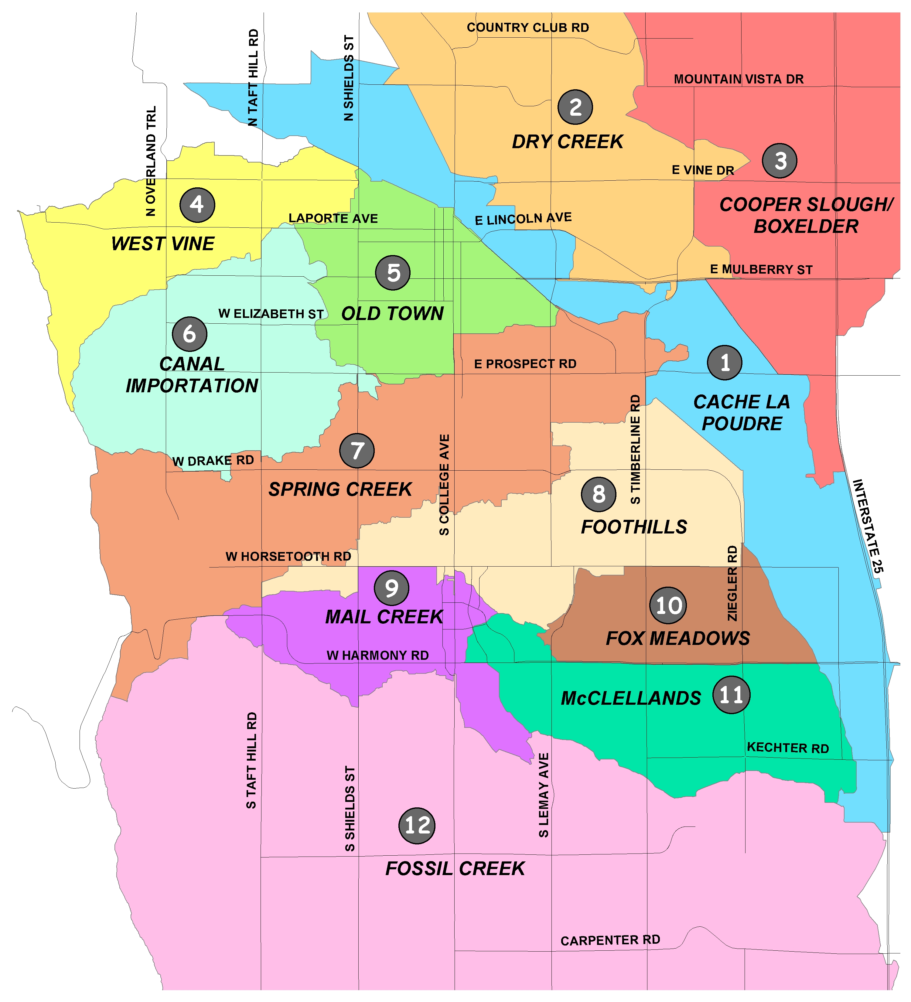
Improvement Maps by Drainage Basin#
- Cache la Poudre - none proposed
- Dry Creek (PDF 14.7MB)
- Cooper Slough/Boxelder (PDF 3.9MB)
- West Vine (PDF 1.2MB)
- Old Town (PDF 3.3MB)
- Canal Importation (PDF 4.3MB)
- Spring Creek (PDF 3.5MB)
- Foothills (PDF 14.4MB)
- Mail Creek (PDF 14.1MB)
- Fox Meadows (PDF 1.0MB)
- McClellands (PDF 1.2MB)
- Fossil Creek (PDF 1.2MB)
Did You Know?
To keep your dryer working at its best, make sure its vent pipe is not kinked or blocked.
Insulating hot water pipes leading from the water heater helps keep your hot water from cooling off before it gets to the tap.
There are 13 stormwater basins within the City of Fort Collins Growth Management Area, each with their own master plan.